Order Total (1 Item Items):
Shipping Destination:

Geographia Road Map England Wales (25 results)
Feedback
Skip to main search results
Search filters
Product Type
- All Product Types
- Books (16)
- Magazines & Periodicals (No further results match this refinement)
- Comics (No further results match this refinement)
- Sheet Music (No further results match this refinement)
- Art, Prints & Posters (No further results match this refinement)
- Photographs (No further results match this refinement)
- Maps (9)
- Manuscripts & Paper Collectibles (No further results match this refinement)
Condition
- All Conditions
- New (No further results match this refinement)
- Used (25)
Binding
Collectible Attributes
- First Edition (5)
- Signed (No further results match this refinement)
- Dust Jacket (No further results match this refinement)
- Seller-Supplied Images (19)
- Not Print on Demand (25)
Language (2)
Free Shipping
Seller Location
Seller Rating
-

"Geographia" 2miles to 1 Inch Road Map of England and Wales in 19 Sheets No 7 North Wales
Published by Geographia, London
Language: English
Soft cover. Condition: VG. Dust Jacket Condition: No Dustwrapper. folding linen backed map measuring 31"/40". No date but circa 1930.
-

Geographia Cyclist's Map No 2 South West England and South Wales. Clear Road Map.
Published by Geographia Ltd, London, England., 1960
Language: English
Map
Soft cover. Condition: Near Fine. Fold-out map still in original folds - looks unused. Undated but cost 9d so pre 1970, probably 1950/60s.
-

Geographia 2 miles to one inch road map of England and Wales No10 Norfolk and North Suffolk. 31 x 40 inches.
Published by Geographia Ltd., London, England, 1960
Language: English
Map
Map. Condition: Good. In nice clean condition. Undated, cost 2/6d (12.5p) probably about 1960. Rubber stamp to front and back of cover.
-
Geographia's Road Map of England & Wales - No12 Hereford, Monmouth & Gloucester
Published by Geographia
Language: English
Seller: St Oswald's Hospice, Newcastle, United Kingdom
Seller rating 5 out of 5 stars

Map First Edition
Soft cover. Condition: Good. 1st Edition. Geographia - 2 Miles to 1 Inch Road Map of England & Wales in 19 Sheets, Each 31" x 40". NO 12 HEREFORD, MONMOUTH & GLOUCESTER, On 6/6 Cloth. Condition: Minor wear and tear marks to protective cardboard cover. Some yellowing and discolouration marks to cloth panels. No major wear.
-
50 Miles Round Manchester, Arterial & By-Pass Roads Prominently Indicated ("Geographia" Clear Road Map of England & Wales)
Published by "Geographia" Ltd.
Seller: Wonder Book, Frederick, MD, U.S.A.
Seller rating 5 out of 5 stars
Condition: Good. Good condition. No date stated, ca. 1920s. Folded cloth map, 31 x 40 inches. (England, Manchester, Maps) A copy that has been read but remains intact. May contain markings such as bookplates, stamps, limited notes and highlighting, or a few light stains.
-
![Seller image for Geographia Large Scale Road Map of England and Wales Showing Main Roads with Ministry of Transport Numbers [M BM] for sale by Little Stour Books PBFA Member](https://pictures.abebooks.com/inventory/md/md3956301799.jpg)
Geographia Large Scale Road Map of England and Wales Showing Main Roads with Ministry of Transport Numbers [M BM]
Published by Published by Geographia Ltd., 167 Fleet Street, London February [Code U BE] 1945., 1945
Seller: Little Stour Books PBFA Member, Canterbury, United Kingdom
Association Member: PBFA
Seller rating 5 out of 5 stars
Blue card covers with navy lettering to the front. Cloth backed 35 section colour paper map. In Very Good clean condition, priced 5/6 to the front cover. Member of the P.B.F.A. CARTOGRAPHY, MAPS, PLANS.
-
"Geographia" 2 miles to 1 Inch Road Map of England and Wales in 19 Sheets No 7 North Wales
Published by "Geographia" Ltd.
Softcover. Condition: Good. A number of tears along the folds, however all parts are still attached. Some foxing, a few marks to map. Back cover is only attached at one corner. Some fraying. Marks and creasing to covers. ALL ITEMS ARE DISPATCHED FROM THE UK WITHIN 48 HOURS ( BOOKS ORDERED OVER THE WEEKEND DISPATCHED ON MONDAY) ALL OVERSEAS ORDERS SENT BY TRACKABLE AIR MAIL. IF YOU ARE LOCATED OUTSIDE THE UK PLEASE ASK US FOR A POSTAGE QUOTE FOR MULTI VOLUME SETS BEFORE ORDERING.
-
Geographia Numbered Road Touring Map of England and Wales, No. 2 South West Counties
Published by Geographia 0, UK
Seller: The Book Exchange, Macclesfield, United Kingdom
Seller rating 4 out of 5 stars

Soft cover. Condition: Very Good. Softcover map on canvas. Scale is 5 miles to 1 inch. A remarkably well preserved colour map, just light shelf wear, and a few very light stains on the map, (hardly noticeable). Not ex. library. Contents clean, and bright. Undated, cover price is 7/6. Book.
-
Geographia Road Map Of England And Wales
Published by Geographia Ltd., London Circa 1920's/30's, 1920
Seller: BOOKBARROW (PBFA member), Cambridge, United Kingdom
Association Member: PBFA
Seller rating 5 out of 5 stars
Map
Hardcover (linen backed). Condition: Good. Presumed First Edn. an undated coloured map on 30 linen-backed folded panels in green cloth covers showing the major roads (colour-coded 'A', 'B' & 'Other') with their official Ministry of Transport numbers; inset around the edge of the map are city-centre mini road maps for the larger cities & towns; near the top is a 'Distance By Road, Rail And Air' chart which shows also the difference between road & rail distances & the saving in comparison by air travel. n/a. Item Type: Map. minor marking to covers. Gilt titles front (faded). Bumping & wear to corners of covers. Quantity Available: 1. Shipped Weight: Under 1 kilo. Category: Geography & Maps; Road Maps; England; Wales; Britain/UK; Geography & Maps. Inventory No: 3120.
-
Geographia Road Map of England and Wales. 10 miles per square inch
Published by Geographia Ltd [1926], London, 1926
Seller: Barter Books Ltd, Alnwick, NORTH, United Kingdom
Association Member: IOBA
Seller rating 5 out of 5 stars
Map First Edition
Maroon hardback cloth cover. Condition: Good. First Edition. G: in Good condition without dust jacket as issued. 300mm x 160mm (12" x 6"). 30 panels. 30 linen-backed panels. Geographia moved from The Strand to Fleet Street in 1923.
-
Geographia 2 Miles to 1 Inch Road Map England and Wales Map No. 18 Hampshire and West Sussex
Published by Geographia Ltd, London
Soft cover. Condition: Good ++. Orange card covers with blue title lettering to the front cover. 19 sections colour paper map Priced 2/- to the front cover.
-
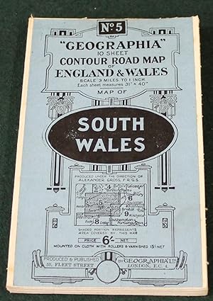
"Geographia" 10 Sheet Contour Road Map of England. Sheet 5, South Wales. Scale 3 miles to 1 inch.
Published by London: Geographia Ltd. circa, 1920
Seller: Bristow & Garland, Shaftesbury, United Kingdom
Seller rating 4 out of 5 stars
Coloured folding map dissected and mounted on linen, 31 x 40 inches, folding within the printed card covers; very good indeed.
-
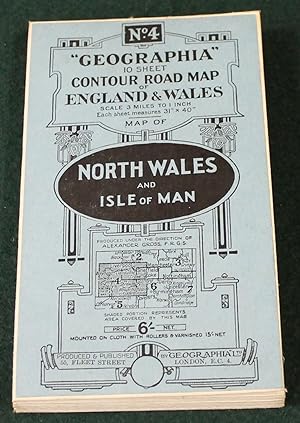
"Geographia" 10 Sheet Contour Road Map of England. Sheet 4, North Wales and Isle of Man. Scale 3 miles to 1 inch.
Published by London: Geographia Ltd. circa, 1920
Seller: Bristow & Garland, Shaftesbury, United Kingdom
Seller rating 4 out of 5 stars
Coloured folding map dissected and mounted on linen, 31 x 40 inches, folding within the printed card covers; very good indeed.
-
![Seller image for Geographia 2 Miles to 1 Inch Road Map England and Wales. Map No. 18 Hampshire and West Sussex Code [CU MN] for sale by Little Stour Books PBFA Member](https://pictures.abebooks.com/inventory/md/md17046892219.jpg)
Geographia 2 Miles to 1 Inch Road Map England and Wales. Map No. 18 Hampshire and West Sussex Code [CU MN]
Published by Published by Geographia Ltd., 55 Fleet Street, London December [Code CU MN]. 1939., 1939
Seller: Little Stour Books PBFA Member, Canterbury, United Kingdom
Association Member: PBFA
Seller rating 5 out of 5 stars
Pale orange card covers with blue title lettering to the front cover. 36 sections colour paper map measuring 31'' x 40''. Tear to one fold and the bottom of the spine cover. In Very Good clean condition, priced 1/8 to the front cover. Member of the P.B.F.A. HAMPSHIRE (Hantescire).
-

Geographia Contour Road Map of England and Wales in 10 Sheets: Sheet No. 10 London and South East Counties
Published by Published by Geographia Ltd., 55 Fleet Street, London 12th July [Code CULUM] 1923., 1923
Seller: Little Stour Books PBFA Member, Canterbury, United Kingdom
Association Member: PBFA
Seller rating 5 out of 5 stars
Pale blue card covers with back title lettering to the front cover. On cloth dissected in to 36 sections colour paper map measuring 31'' x 40''. Some foxing and old staining to the rear cloth, a little fraying to the edges and in Good condition, priced 6/- to the front cover. Member of the P.B.F.A. LONDON (Londinium).
-

Geographia Contour Road Map of England and Wales in 10 Sheets: Sheet No. 5 South Wales
Published by Published by Geographia Ltd., 167 Fleet Street, London circa [No Code] 1920., 1920
Seller: Little Stour Books PBFA Member, Canterbury, United Kingdom
Association Member: PBFA
Seller rating 5 out of 5 stars
Blue card covers with back title lettering to the front cover. On cloth dissected in to 36 sections colour paper map measuring 31'' x 40''. In Very Good clean condition, priced 6/- to the front cover. Member of the P.B.F.A. WALES & WELSH LITERATURE.
-

30 linen-backed sections measuring 48 x 40 inches, folding into cloth covered casing measuring ca. 10 x 7 inches. Some marks / dings to casing; map in very good condition. Believed to date from the 1920s.
-
"Geographia" 2 Miles to 1 Inch Road Map England & Wales No.7 North Wales
Published by Geographia Ltd, London
Map
Soft cover. Condition: Good. 90 grams.
-

MIDLAND COUNTIES, GEOGRAPHIA CONTOUR ROAD MAP OF ENGLAND AND WALES, N� 6
Published by Geographia Ltd
Map
Pas de couverture. Condition: bon. RO60106934: Non dat�. In-8. En feuillets. Etat d'usage, Couv. l�g�rement pass�e, Dos satisfaisant, Quelques rousseurs. Carte entoil�e d�pliable en couleur, d'env. 100/75 cm (recto uniquement). Quelques taches sur les bords. . . . Classification Dewey : 912-Atlas, cartes et plans.
-
Geographia Numbered Road Touring Map of England and Wales. No. 4, Northern Counties
Published by Geographia Ltd, no date 0, London
Hardcover. Condition: Very Good+. No Jacket. 1st Edition thus?. 12431 shelf. Pre-WWII folded map in green hardcover w/ small map paste-down on front. A little wear spine ends. Scale 5 miles to one inch. Arterial & by-pass roads prominently indicated. Liverpool, Manchester & Chester area. No names, clean text. Attractive. Book.
-

"Geographia" Two-Sheet Road Map of England & Wales
Published by Published by "Geographia" Ltd. no date given [1924], London, 1924
Seller: Keoghs Books, Skipton, United Kingdom
Association Member: PBFA
Seller rating 4 out of 5 stars
Map First Edition
, 30-section folding map, linen-backed with paper sections, with 23 insets of major cities around edges, 'based upon the Ordnance Survey maps.' First Edition thus , few light stains to cloth and corners rubbed, dampstains to linen, map tanned but clean, few small chips to top edge but not affecting map, in good condition , red cloth covers 128 x 106 cm folding into 27 x 18 cm Map ISBN:
-

"Geographia"- Two Sheet Road Map of England and Wales
Published by London: H.M. Stationery Office, 1930
First Edition
1st edition. Very good copy on color printed linen over sand-grain cloth board. Date is suggested. Physical description: folded sheet; maps; 128 x 100cm. Subjects: Maps. By-Pass roads. Ministry of Transport. Railways. Canals. Exit Roads. Ferries for Vehicles.Cartography. England. Wales. Travel and Description. Cartographic images. 1 Kg.
-
Geographia Road Map of England and Wales
Seller: Oast Park Books, Southend -on- Sea, ESSEX, United Kingdom
Seller rating 5 out of 5 stars
c1930. Hardback. Large folding map canvas backed. Map - Fair.
-

ENGLAND & WALES- Geographia two-sheet road map of England & Wales. (South Sheet) Scale of miles,
Published by Geographia [1924], London, 1924
Seller: ANTIQUARIAT.WIEN Fine Books & Prints, Wien, Austria
Seller rating 5 out of 5 stars
Map
Karte, mehrfarbig, 99x 78 cm, in 36 Segmenten gefaltet und auf Leinen aufgezogen, mit 11 Stadtdurchfahrtspl�nen am Rand , 3 1/2 Meilen zu 1 Inch, a very good copy The South Sheet includes the whole of Wales and all hat part of England South Liverpool and Sheffiel, with exit Plans of Londen and 10 other important towns an 155 Landkarte.