Order Total (1 Item Items):
Shipping Destination:

Royal Atlas by Johnston (33 results)
Feedback
Skip to main search results
Search filters
Product Type
- All Product Types
- Books (27)
- Magazines & Periodicals (No further results match this refinement)
- Comics (No further results match this refinement)
- Sheet Music (No further results match this refinement)
- Art, Prints & Posters (No further results match this refinement)
- Photographs (No further results match this refinement)
- Maps (6)
- Manuscripts & Paper Collectibles (No further results match this refinement)
Condition
- All Conditions
- New (No further results match this refinement)
- Used (33)
Binding
- All Bindings
- Hardcover (29)
- Softcover (No further results match this refinement)
Collectible Attributes
- First Edition (4)
- Signed (No further results match this refinement)
- Dust Jacket (No further results match this refinement)
- Seller-Supplied Images (23)
- Not Print on Demand (33)
Language (2)
Free Shipping
Seller Location
Seller Rating
-
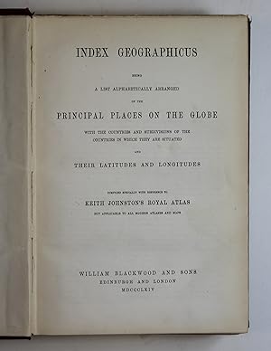
Index Geographicus Being A List Alphabetically Arranged of The Principal Places on The Globe With The Countries and Subdivisions of The Countries in Which They Are Situated and Their Latitudes and Longitudes | Compiled Specially with Reference to Keith Johnston's Royal Atlas but Applicable to all Modern Atlases and Maps.
Published by William Blackwood, Edinburgh,, 1864
Language: English
Hardcover. Condition: Good. No Jacket. This book is in good condition. Rubbing and wear to the cloth at the spine. Internally a very good clean copy. Free from inscriptions, markings or signs of wear to the pages.
-

Spain - from Keith Johnston's Royal atlas of modern Geography. Spain and Portugal.
Published by Edinburgh u London W Blackwood oJ
Seller: Neusser Buch & Kunst Antiquariat, Neuss, NRW, Germany
Seller rating 4 out of 5 stars

0. Gr.-8�. 1 mehrfachgef. Kte. a. Leinwand gezogen. Leinwand. Vergold. Deckeltitel. Cloth. Gilt title on spine. Stark ber. u. best. Stock- u. fingerfl. Rubbed and bumped. Foxed and stained. Auf Wunsch senden wir gerne ein Foto des Buches via E-mail Sprache: Deutschu 0,421 gr.
-
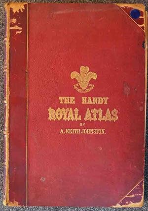
The Handy Royal Atlas Of Modern Geography
Published by W & A K Johnston, 1944
Seller: Sequitur Books, Boonsboro, MD, U.S.A.
Association Member: IOBA
Seller rating 5 out of 5 stars

Hardcover. Condition: Very Good. Bound in green cloth. Gilt lettering. Hardcover. Good binding and cover. Shelf wear. Edge rubbed. Owner's name on verso, else unmarked. This is an oversized or heavy book, which requires additional postage for international delivery outside the US.
-
![Seller image for Map of N.W. Africa comprising Marocco, Algeria & Tunis and Map of South Africa with electoral divisions in Cape Colony and Counties in Natal [ taken from Johnston's Handy Royal Atlas ] for sale by Keoghs Books](https://pictures.abebooks.com/inventory/md/md510759882.jpg)
Map of N.W. Africa comprising Marocco, Algeria & Tunis and Map of South Africa with electoral divisions in Cape Colony and Counties in Natal [ taken from Johnston's Handy Royal Atlas ]
Published by Published by W. & A.K. Johnston, Edinburgh, 1878
Seller: Keoghs Books, Skipton, United Kingdom
Association Member: PBFA
Seller rating 4 out of 5 stars
Map First Edition
, 36.5 x 47.5 cm double page plate with guard mount, heavy paper with gilt edge, numbered 37, with two engraved colour maps First Edition thus , central fold, paper toned, near fine condition 47.5 x 36.5 cm Map ISBN:
-
![Seller image for Map of Upper Nubia and Abyssinia [ taken from Johnston's Handy Royal Atlas ] for sale by Keoghs Books](https://pictures.abebooks.com/inventory/md/md510759876.jpg)
Map of Upper Nubia and Abyssinia [ taken from Johnston's Handy Royal Atlas ]
Published by Published by W. & A.K. Johnston, Edinburgh, 1878
Seller: Keoghs Books, Skipton, United Kingdom
Association Member: PBFA
Seller rating 4 out of 5 stars
Map First Edition
, 36.5 x 47.5 cm engraved map with colour, 2 cm margins, a double page plate with guard mount, heavy paper with gilt edge, numbered 39 First Edition thus , central fold with slight tear, paper toned, good condition 47.5 x 36.5 cm Map ISBN:
-

Index Geographicus Being A List Alphabetically Arranged of The Principal Places on The Globe With The Countries and Subdivisions of The Countries in Which They Are Situated and Their Latitudes and Longitudes | Compiled Specially with Reference to Keith Johnston's Royal Atlas but Applicable to all Modern Atlases and Maps.
Published by Published by William Blackwood and Sons, Edinburgh and London . 1864,, 1864
Seller: Little Stour Books PBFA Member, Canterbury, United Kingdom
Association Member: PBFA
Seller rating 5 out of 5 stars
Hard back binding in publisher's original maroon pebble cloth covered boards, blocked and lettered gilt back, dark green end sheets. 4to. 10�'' x 7�''. Contains 676 pp + publisher's catalogue. Snagging of the cloth across the top of the spine, contents in Very Good clean condition. Heavy volume weighing 2 kg, extra postage and insurance will be requested over and above our default setting for destinations outside of the UK. Member of the P.B.F.A. GEOGRAPHY (Human, Physical).
-
Handy Royal Atlas of Modern Geography : A New Edition
Published by W. & A.K. Johnston, London, 1881
Language: English
Seller: David's Bookshop, Letchworth BA, Letchworth Garden City, HERTS, United Kingdom
Seller rating 5 out of 5 stars
Hardcover. Condition: Fair. No Jacket. Red leather binding, contrasting red leather to the spine and corners,5 raised bands along spine piece with gilt titles, gilt title and decoration to the top board. This binding is in one piece but the text block is detached along the front, but remains attached at the back.The binding shows rubbing and loss of top layer of leather along the edges. The first quarter of the pages and maps are detached but present. The coloured maps are two-page fold out and in extremely good condition, each with a library stamp on the plain back side. It is complete, and worthy of attention to binding. May incur additional postage outside Europe.
-
Hardcover. Condition: Good. No Jacket. 1/4 Leather, some wear to covers and spine, mainly edges and corners, corners a little bumped and surface of leather worn, top and bottom of spine a little worn, some small marks and stains on covers, gilt edges all round still bright, internally in good condition, pages crisp and clear, but slightly yellowing and some light foxing. 38 cm x 27 cm x 5 cm. 3.8 kg. The price includes postage and packing to a UK Mainland address, due to the weight there will be an additional charge to everywhere else, please ask for a quote.
-
THE ROYAL ATLAS OF MODERN GEOGRAPHY
Published by William Blackwood, London, 1875
Language: English
Seller: THOMAS RARE BOOKS, Yaxley, SUFFOLK, United Kingdom
Seller rating 3 out of 5 stars

Hardback. Condition: Fine. New Edition. 20 x 13,5 inches. 48 double page folding colour maps and the North Polar Chart as a frontis. Fine original red half calf binding with gilt titles. Specail; index after each map. The fourth edition with each map updated to reflect the ever changing speed of the changes taking place in the industrail age. Dedication page to Queen Victoria. Each map as an adjacent index bound in and a prospectus for the companion book to the atlas is bound in at the front [Atlas Geographicus' pub. separately]. A complete and fine copy.
-
India From Keith Johnston's Royal Atlas. With Index
Published by Keith Johnston, London June 1907, 1907
Hardcover. Condition: As New. . . . . Folding lithograph map mounted on linen, folding into publisher's cloth boards; with index of place names; blue cloth with gold lettering; top and bottom of spine rubbed, dark blue cloth showing predictable age wear; otherwise fine, map and index fine.
-
Handy Royal Atlas of Modern Geography exhibiting the present condition of geographical discovery and research in the several countries, empires, and states of the World
Published by W. & A. K. Johnson, Edinburgh & London, 1877
Seller: George Jeffery Books, HERTFORDSHIRE, United Kingdom
Association Member: PBFA
Seller rating 5 out of 5 stars
Half Calf. Condition: Very Good. Book measures 38x27.cm. [8],101pp, 45 double page coloured maps, 1 double page coloured chart. Bound in period half calf, calf corners, cloth boards, raised bands, gilt lines, crest and lettering, full gilt edges, coloured endpapers. Binding rubbed, scuffed, wear on joints, but binding holding firm. Internally, pages and maps clean thrioughout. A nice clean copy, in a good binding. Size: Small Folio.
-
The Royal Atlas of Modern Geography
Published by William Blackwood & Sons, Edinburgh & London, 1875
Seller: George Jeffery Books, HERTFORDSHIRE, United Kingdom
Association Member: PBFA
Seller rating 5 out of 5 stars
Half Calf. Condition: Near Very Good. Book measures 51.5x35.cm. viii,[1], 48 double pages coloured maps, plus index. Bound in period half calf, calf corners, cloth boards, raised bands, gilt crest, tooling, and lettering. Binding rubbed, worn, on edges and corners. At some time the inner joints have been strengthened with binders tape. Binding in good firm condition. Internally, pages and maps very clean throughout. Generally a very good clean copy, in a worn, but firm binding. Size: Folio.
-
The Handy Royal Atlas of Modern Geography . by the late Alexander Keith Johnston with additions and corrections to the present date by G. H. Johnston
Published by W. & A. K. Johnson, Edinburgh & London, 1914
Seller: George Jeffery Books, HERTFORDSHIRE, United Kingdom
Association Member: PBFA
Seller rating 5 out of 5 stars
Half Calf. Condition: Very Good. Book measures 37.5x26.5.cm. (6), (84pp index), with 61 coloured maps. Bound in original publishers quarter calf, calf corners, cloth boards, raised bands, gilt lines and lettering, full gilt edges, marble endpapers. Calf rubbed, abrasion wear on corners, edges. Generally binding in good condition. Internally, inscription dated 1924 on fixed endpaper. Pages and maps in very good clean condition. A good clean copy. Size: Quarto.
-
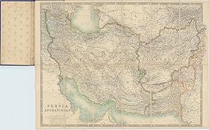
Persia and Afghanistan. From Keith Johnston's Royal Atlas.
Published by LondonJohnston March ., 1914
Seller: Robert Frew Ltd. ABA ILAB, London, United Kingdom
Association Member: ABA ILAB PBFA
Seller rating 4 out of 5 stars
Map
Original colour printed map of Persia and Afghanistan (46 x 62 cm), dissected into 12 sections and backed onto linen, folding between original blue cloth covers lettered in gilt. An excellent copy. The Russian and British spheres of interest are overlaid in red rule. On the Persian Gulf are marked the cities of 'Abu Debi or Thabi' (Abu Dhabi), 'Debai' (Dubai) and other emirates.
-
Handy Royal Atlas of Modern Geography Exhibiting the present condition of geographical discovery and research in several countries , empires and states of the world
Published by William Blackwood, 1874
Seller: Arader Galleries of Philadelphia, PA, Philadelphia, PA, U.S.A.
Seller rating 5 out of 5 stars
Hardcover. Condition: Very Good. book in vg shape save some light foxing on blank for-pages the leather spine and lethar corners show rubbing large book is very tight and maps all very good green boards with gold gilt print raised ribs on spine 45 double page maps with index in rear gilt page edges around.
-
The Handy Royal Atlas of Modern Geography . by the late Alexander Keith Johnston with additions and corrections to the present date by G. H. Johnston
Published by Edinburgh & London, 1914
Seller: Clive A. Burden Ltd., Chalfont St. Giles, BUCKS, United Kingdom
Seller rating 3 out of 5 stars
No binding. Large quarto (380 x 260 mm.) original publisher's half calf with green cloth boards, gilt ruled with gilt title and ornate motto to upper board, original ornate endpapers, light wear to upper spine. With title page, pp. (6), (84), with 61 coloured maps The successful firm of W. & A. K. Johnston was founded by Sir William Johnston and was based in Edinburgh from 1825. The following year he was joined by his brother Alexander Keith Johnston. In 1861, the firm published the 'Royal Atlas' dedicated to the Queen in which Price Albert had shown great interest. A reduction of this popular work was published in 1868 entitled the 'Handy Royal Atlas' dedicated to the Prince of Wales. It 'resembled its parent closely in the style and quality of its 45 double-page maps' (Smith). The atlas was enlarged at first to 52 maps and then again here to 62. For this issue, the maps are numbered to 51 with separate un-numbered maps of the North and South Poles recording the latest explorations. Further new maps included one of Manchuria reflecting the conflict for control of the region, Indo-China, Japan & Korea, Southern Rhodesia which declared great support for Britain at the outbreak of World War I, 'Natal and Orange Free State' reflecting the Maritz Rebellion or Boer Revolt, Mexico to illustrate the Civil War 1913-14 and finally one of Chile and Argentina. A fascinating atlas recording accurately the world at the outbreak of the First World War. Provenance: Clive A. Burden Ltd. (2017) Catalogue XIV item 95; private English collection. Smith, (2000); Smith (2001).
-
Handy Royal Atlas of Modern Geography Exhibiting the Present Condition of Geographical Discovery and Research in the Several Countries, Empires, and States of the World
Published by Edinburgh, Edinburgh, 1883
Seller: High Ridge Books, Inc. - ABAA, South Deerfield, MA, U.S.A.
Association Member: ABAA ESA ILAB SNEAB
Seller rating 5 out of 5 stars
1/2 red leather with gilt-stamped cloth, well worn and rubbed at extremities and along joints. 45 double-page maps in full color with borders highlighted. AEG. Editions of this fine world atlas were published from 1869 until early into the 20th century.
-
Handy Royal Atlas of Modern Geography exhibiting the Present Condition of Geographical Discovery and Research in the Several Countries, Empires and States of the World
Published by Published by W. & A.K. Johnston, Edinburgh and London, 1892
Seller: Keoghs Books, Skipton, United Kingdom
Association Member: PBFA
Seller rating 4 out of 5 stars
Map
, 52 large double page coloured maps with index to rear Later edition , light rubbing to spine, corners and joints, hinges reinforced, maps and pages clean, very good condition , half morocco and stippled cloth, five raised bands and gilt titles to spine, gilt titles to front, full gilt edges, patterned endpapers , large quarto, 38 cm 27 cm Hardback ISBN:
-
The Royal Atlas of Modern Geography, exhibiting in a series of entirely original and authentic maps,the present condition of geographical discovery and research in the several countries, empires, and states of the world
Published by William Blackwood & Sons, 1861
Seller: McLaren Books Ltd., ABA(associate), PBFA, Largs, United Kingdom
Association Member: ABA ILAB PBFA
Seller rating 5 out of 5 stars
folio [51x34cm]. 9 pages of introductory text followed by 48 stunning double-page spread and part coloured maps, each with a special index. the original half leather binding is well worn, with loss to spine, and front board is nearly detached. internally there is some dust-soiling and marking to the margins, but on the whole the maps are very fresh, with just occasional spotting [heavy book that will require extra shipping costs for overseas orders].
-
Hardcover. Condition: Good. No Jacket. 1/4 Leather, some wear to covers and spine, mainly edges and corners, corners bumped and worn, boards showing, top and bottom of spine bumped and worn, small rip at top 1.5cm, sides and surface of raised bands worn, small rip at bottom of spine join with cover 3 cm, a few small marks and stains on covers, gilt edges all round still bright, internally in good condition, pages crisp and clear. 50 maps + index. 35.5 cm x 51 cm x 6 cm Weight 6.9 kg. The price includes postage and packing to a UK Mainland address, due to the weight there will be an additional charge to everywhere else, please ask for a quote.
-
The Royal Atlas of Modern Geography: Exhibiting, in a series of entirely original and authentic maps, The present condition of geographical discovery and research in the several countries, empires, and states of the world.
Published by London: W. & A. K. Johnston., 1903
Seller: Louis88Books (Members of the PBFA), Andover, United Kingdom
Association Member: PBFA
Seller rating 5 out of 5 stars
Hardcover. Condition: Good. W. & A. K. Johnston, Limited, Edinburgh, 1903. Half Leather. Revised Edition. Elephant Folio. Original 1903 revised Royal Atlas bound in one volume containing all the maps. Colour maps are in excellent condition with no markings and no creases and no stains. Elephant folio (20"H X 14"W) half leather and brown pebbled cloth covers are Good condition with bright and complete front and spine titles/crown & sword motif, wear to leather. Some early pages stand proud of the volume (see photos) and the edges of the first 9 maps are slightly damaged. Rear cover and spine are detaching from the contents (see photos). No markings to text, all edges gilt. All the maps are here in fine condition in a presentable original binding. MASSIVE costs for international shipping - but quote exact postage. Condition Report Externally Original binding half leather with gilt decorated boards Covers detaching from the text Leather worn and scratched All edges gilt Corners bumped See above and photos Internally Internally clean and bright. Contents in good order See photos.
-
The Royal Atlas of Modern Geography (Exhibiting in a Series of Entirely Original and Authentic Maps the Present Condition of Geographical Discovery and Research in the Several Countries, Empires and States of the World)
Published by Published by W & A K Johnston, Edinburgh, 1887
Seller: Keoghs Books, Skipton, United Kingdom
Association Member: PBFA
Seller rating 4 out of 5 stars
Map
, unpaginated, 54 coloured numbered maps with titles (including un-numbered frontispiece), double hatched border with Longitude and Scales (including Geographical Miles, French Kilometres, English Statute Miles), key to Railways Canals Forests and Sites of Battles, Index to each map, binder's label to lower pastedown New Edition , slight rubbing to covers and scuffing to lower board, squashed spiders to Index of Map 30 and 32, border of Asia map darkened and frayed, small tear to border and joints of frontispiece, generally very nice and tidy withing, very good condition , half bound brown cloth and brown morocco, gilt rules to covers, gilt illustration and titles to upper board, raised bands to spine, gilt decoration in compartments with titles, all edges gilt, gilt turn-ins, purple decorative endpapers large folio, 51 x 35 cms Hardback ISBN:
-
THE ROYAL ATLAS OF MODERN GEOGRAPHY, EXHIBITING IN A SERIES OF ENTIRELY ORIGINAL AND AUTHENTIC MAPS,THE PRESENT CONDITION OF GEOGRAPHICAL DISCOVERY AND RESEARCH IN THE SEVERAL COUNTRIES, EMPIRES, AND STATES OF THE WORLD
Published by William Blackwood & Sons,, Edinburgh & London, 1861
Seller: Burwood Books, Wickham Market, United Kingdom
Association Member: PBFA
Seller rating 5 out of 5 stars
First Edition
Hardcover. Condition: Very Good. First Edition. Hardback. Folio [51x34cm]. 9 pages of introductory text followed by 48 double-page spread and part coloured maps, each with a special index. Bound in recent dark green half leather lettered gilt at the spine. This book is very heavy, and delivery costs may be a consideration especially outside Britain. Very good indeed.
-
The Royal Atlas of Modern Geography
Published by Johnston, 1879
Seller: Barry Lawrence Ruderman, La Jolla, CA, U.S.A.
Seller rating 5 out of 5 stars
Hardcover. Condition: VG. Johnston / 1879 / The Royal Atlas of Modern Geography (Safe 3, 109605) Folio. Original publisher's half morocco over cloth, raised bands, all edges gilt. Spine gilt. Front cover with gilt titling and sword and crown decoration. Edges worn. Old dampstaining on front cover, a few scratches to cloth on back cover. Internal hinges a bit shaken, but still solidly attached. Half title, preface, contents. Total of 54 double-page maps (North Polar Chart as unnumbered frontispiece plus 53 numbered maps). Internally clean and nice. Highly detailed large folio world atlas, published by W & A.K. Johnston, one of the leading map publishers in the United Kingdom in the second half of the 19th Century. The atlas was first published in 1861. The present edition is updated with additions and consists of 53 double page maps, provides a fine overview of the world, with special emphasis on the United Kingdom and British Colonies around the world, as well as a fine large map of the Western United States. Some of the notable changes in this edition include separate maps for: Canada West ("rapidly increasing importance as a new field for emigrations") and Mexico (previously on the general map of North America). The United States takes up two double-sheets (split at the Mississippi River). Book.
-
Royal Atlas of Modern Geography. Exhibiting in a Series of Entirely Original and Authentic Maps, the Present Condition of Geographical Discovery and Research in the Several Countries, Empires, and States of the World. With Index Geographicus. 2 volume set
Published by William Blackwood & Sons, Edinburgh, 1861
Seller: Barter Books Ltd, Alnwick, NORTH, United Kingdom
Association Member: IOBA
Seller rating 5 out of 5 stars
Map First Edition
Condition: Good. First Edition. G : in good condition. Cover rubbed with edgewear. Content in very good condition. 260mm x 170mm (10" x 7"). ix, [124pp] + maps; 676pp. 48 double-page colour maps. Index published 1864. Index volume Ex-lib. in black library binding. Heavy set extra shipping needed for overseas. Red hardback half-leather cover.
-
Handy Royal Atlas of Modern Geography.
Published by Edinburgh and London: W. & A. K. Johnston, 1898., 1898
Seller: Arader Galleries - AraderNYC, New York, NY, U.S.A.
Seller rating 5 out of 5 stars
Folio, (15 x 10 � inches). 52 fine chromolithographed maps, including frontispiece "North Polar Chart" (a few pale marginal stains). Original publisher's burgundy half morocco, lettered in gilt, the spine in six compartments, with five raised bands, gilt-lettered in one, all edges gilt (extremities rubbed). Provenance: From the distinguished library of Christopher Henry Beaumont Pease, Lord Wardington (1924-2005), his sale, Sotheby's, October 18, 2005. With the ink stamp: "F. J. Walker, Mezzo-Monte, Cannes, France to endpapers. Second edition, reduced and with new information from the original 1861 edition. With a dedication to the Prince of Wales rather than Queen Victoria, and revised to reflect the political and territorial changes that had occurred. "The modified boundaries of Greece and Turkey consequent on the recent war. The respective leased territories of Britain, Germany, and Russia in China; the newly settled boundary between Afghanistan and Baluchistan, with the finally adjusted boundary of the Pamir between Russia and Britain; the route of the Trans-Siberian Railway, and the principal names mentioned in connection with the recent frontier war in North-West India. In Western Australia all the chief mining centres and latest travellers' routes. On the Nile, the military railway laid across the Nubian Desert by the British and Egyptian Expedition. In Abyssinia and Somali Land the new treaty boundaries as agreed to by Menelek and Great Britain, France, and Italy. In West Africa the new boundaries limiting the Royal Niger Company Territory, agreed on by Great Britain and France. The new divisional arrangements of the Dominion of Canada, and the names connected with the different routes to the Klondike goldfields. Since the Map of West India Islands was printed Spain has ceded Cuba and Puerto Rico to the United States. The northern boundary of Paraguay with Bolivia, as also the modified boundary of North Argentine and Chile. The route taken by Dr. Nansen in the Fram, and subsequent homeward return journey. Recent exploration in Franz Joseph Land, exhibiting considerable changes in the delineation of that region" (from the Preface). Includes several nice maps of Australia and New Zealand, showing colonial boundaries and territories. Two have insets of Tasmania and the Cape York Peninsula. There are also a number of maps showing the United States: one showing the whole country, and the others split up into "North Eastern Sheet" (with an inset of Maine), "South Eastern Sheet" (with an inset of "The Atlantic States Between Boston & Philadelphia"), "Central Sheet," and "Western Sheet." Other maps include: "West India Islands and Central America" and two maps of South America ("Northern Sheet" and "Southern Sheet"), one with an inset of the Galapagos Islands.
-
THE ROYAL ATLAS OF MODERN GEOGRAPHY. Exhibiting in a series of entirely orfiginal and authentic Maps, the present condition of Geographical Discovery and Research in the several Countries, Empires, and States of the World.
Published by Edinburgh and London ;- William Blackwood & Sons., 1874
Seller: HALEWOOD AND SONS ABA ILAB Est. 1867., PRESTON, United Kingdom
Association Member: ABA ILAB PBFA
Seller rating 3 out of 5 stars
Hardcover. Condition: Good. IMPOSING LARGE FOLIO ATLAS ! New Edition. 48 Fine Double-page outline-coloured Maps (including 8 of The Americas.) With a Special Index to each Map. Half Original maroon morocco (rubbed & worn). internally sound and clean bar light marginal water-staining in places. A.e.gilt.
-
India from Keith Johnston's Royal Atlas. [title on map: India (Northern Sheet)].
Seller: Antiquariaat A. Kok & Zn. B.V., Amsterdam, Netherlands
Seller rating 5 out of 5 stars
[Edinburgh & London ?], [ca. 1875/21880]. Large steel-engraved map (in 24 sections) [size: 90 x 62,5 cm. ], coloured in outlines and mounted on linen. Together with a loose index (6 fold. pages) in a modern hardcover case (orig. frontcover with gilt title preserved). - Index discol., strengtened with tape & with a stamp.Single edition of maps 33 & [34] from Keith Johnston's Royal Atlas.
-

Handy Royal Atlas of Modern Geography - mit Beiheft
Published by Edinburg; London, W. & A. K. Johnston, 1877, 1877
Seller: Antiquariat & Kunsthandlung Bachmann & Rybicki - Dresden, Dresden, Germany
Seller rating 5 out of 5 stars
gr.Folio(49x35cm), Titel, 1 nn.S.(1), 3 nn.S.(1), 1 nn.S.(1), 50 Karten mit jeweiligem Register, Beiheft mit Titel, 2 Bll., 2 Karten, Halbleineneinband - Atlaswerk mit Beiheft - Einband berieben und besto�en, Vorsatz mit altem Stempel und hs. Vermerk, Titel mit alten Bibliotheksstempel und hs. Vermerken, Papier altersbedingt gebr�unt und fingerfleckig, Beiheft knickspurig, Titel mit alten Bibliotheksstempeln und hs. Vermerken, Ecken leicht l�diert, Papier altersbedingt gebr�unt und fingerfleckig.
-
Keith Johnston's Royal Atlas of Modern Geography
Published by W. & A. K. Johnston, Edinburgh and London, 1903
Seller: BASEMENT BOOKS, Albuquerque, NM, U.S.A.
Association Member: IOBA
Seller rating 4 out of 5 stars
Half-Leather. Condition: About Fine. New Edition Stated. A New Edition, with Additions and Corrections to the Present Date. By the late Alexander Keith Johnston Geographer to the Queen of Scotland [etc] with additions and corrections to the present date by T. B. Johnston, Geographer to the Queen [etc] with a special Index to each map. Dedicated to "Her Most Gracious Majesty, Queen Victoria". Hard cover Elephant Folio (20"x14") in Green cloth w/black leather spine and corners, gold dec and titles. 56 Maps. "It is hoped that this edition will be equal to its predecessor, which, in the opinion of 'The Times' was the best Atlas ever produced in this country". About Fine w/scuffed covers, else Fine and unmarked. Maps in gorgeous shape, a rare find. Sorry, NO Priority or International. Book.