Order Total (1 Item Items):
Shipping Destination:

The Gough Map (7 results)
Feedback
Skip to main search results
Search filters
Product Type
- All Product Types
- Books (6)
- Magazines & Periodicals (1)
- Comics (No further results match this refinement)
- Sheet Music (No further results match this refinement)
- Art, Prints & Posters (No further results match this refinement)
- Photographs (No further results match this refinement)
- Maps (No further results match this refinement)
- Manuscripts & Paper Collectibles (No further results match this refinement)
Condition
Binding
Collectible Attributes
- First Edition (2)
- Signed (No further results match this refinement)
- Dust Jacket (1)
- Seller-Supplied Images (5)
- Not Print on Demand (6)
Language (2)
Free Shipping
Seller Location
Seller Rating
-
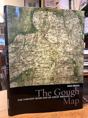
The Gough Map: The earliest road map of Great Britain?
Published by Bodleian Library, University of Oxford 2008, Oxford, 2008
ISBN 10: 1851240225 ISBN 13: 9781851240227
Language: English
Seller: Foster Books - Stephen Foster - ABA, ILAB, & PBFA, London, United Kingdom
Association Member: ABA ILAB PBFA
Seller rating 5 out of 5 stars

Hardcover. Condition: Near Fine. Scarce. 95 pp. Black hardback in a colour illustrated jacket. Minimal rubbing to jacket extremities. Board clean, internally clean. A study - with many colour illustrations - of early maps of Britain, particularly the Gough Map, a 650 year old medieval map that was arguably the first to depict a recognisable British coastline as well as road and river routes between towns. Includes a fold-out reproduction of the map at rear. 1851240225 4to.
-

The Details of Kent shown on the mid-fourteenth Gough Map.
Published by Academic Journal Offprint from: - Archaeologia Cantiana, Volume 130, 2010., 2010
Seller: Nar Valley Books & Prints, King's Lynn, United Kingdom
Seller rating 5 out of 5 stars
10pp, 1 figs, Printed Card Cover, VGC, All our offprints are original printed matter, they are not reprints or photocopies.
-
EARLY MAPS OF GREAT BRITAIN: 1. THE MATTHEW PARIS MAPS; II. THE GOUGH MAP; III. AEGIDIUS TSCHUDI'S MAPS
Published by Geographical Journal, London, 1933
Magazine / Periodical First Edition
Pamphlet. Condition: Very Good. 1st Edition. Vol 81, No 1, January, 1933, pp. 27-45+ 2 Map Plts & Lge FoldOut Map (12 x 17 Inches), Extracted from orig vol, begins with title page, trimmed & stapled, thus is like a pamphlet, last page in facsimile, else VG.
-
![Seller image for The map of Great Britain circa A.D.1360, known as the Gough map; an introd. to the facsim. With The roads of the Gough map, by Sir Frank Stenton. 1958 [LeatherBound] for sale by S N Books World](https://pictures.abebooks.com/inventory/md/md31650025486.jpg)
LeatherBound. Condition: New. Leatherbound edition. Condition: New. Leather Binding on Spine and Corners with Golden leaf printing on spine. Bound in genuine leather with Satin ribbon page markers and Spine with raised gilt bands. Pages: 56. A perfect gift for your loved ones. Reprinted from 1958 edition. NO changes have been made to the original text. This is NOT a retyped or an ocr'd reprint. Illustrations, Index, if any, are included in black and white. Each page is checked manually before printing. As this print on demand book is reprinted from a very old book, there could be some missing or flawed pages, but we always try to make the book as complete as possible. Fold-outs, if any, are not part of the book. If the original book was published in multiple volumes then this reprint is of only one volume, not the whole set. IF YOU WISH TO ORDER PARTICULAR VOLUME OR ALL THE VOLUMES YOU CAN CONTACT US. Resized as per current standards. Sewing binding for longer life, where the book block is actually sewn (smythe sewn/section sewn) with thread before binding which results in a more durable type of binding. Language: English Pages: 56.
-
The War In India: Despatches Of The Rt. Hon. Lt. General Viscount Hardinge, Governor-General Of India, The Right-Honourable General Lord Gough, Commander In Chief, Major-General Sir Harry Smith, Comprising The Engagements Of Moodkee, Ferozeshah, Aliwal And Sobraon, With Map And Seven Diagrams
Published by John Ollivier, London, 1846
Language: English
First Edition
Hardcover. Condition: used/Good. 1st Edition. 1St Edition. Scarce. 193 Pages. Coloured Folding Map Of Northern India Opposite Title Page, Seven Diagrams Of The Battles (Three Of Them Folding), One Folding Table Of Strength And Casualties Of British Regiment Text Block Top Right Corner With A Stain. Text Underlined On Some Pages. Ex Library. Pages With Some Age Toning. Ordinary Paper Boards. One Folding Map As Frontis. Following 7 Plates - 1. Battle Of Ferozshah 2. Sketch Of The Army Of The Sutlaj 3. Folding Map- Position Of The Army Of The Sutlaj 4. Folding Map- Plan Of The Battle Of Aliwal 5. Folding Map- Plan Of The Battle Of Sabraon 6. Single Page - Plan Of The Battle Of Sabraon 7. Single Page- Sketch Of The Encampment Of The Army Of The Sutlej.
-
Nottinghamshire Map 1805 Complete section Ex Gough Camden's Britannia
Published by John Cary, Gough, London, 1805
Hardcover. Condition: Near Fine. 1805. 1805 A Beautifully Hand Coloured JOHN CARY map of Nottinghamshire and 2 engravings. Quarter bound in crushed black morocco with burgundy textured cloth backed boards and gilt titles 270 x 430 mm. MAP IS LARGER! A little shelf rubbed o/w vg. 18pp text Why on Amazon do most sellers not describe their actual book? Buy with confidence and support a genuine Independent Bricks & Mortar Real Bookshop. We are Maynard & Bradley CAMBO & PBFA members here in Leicester City Centre. Why on Amazon do most sellers not describe their actual book? Buy with confidence and support a genuine Independent Bricks & Mortar Real Bookshop. We are Maynard & Bradley CAMBO & PBFA(now lapsed) members here in Leicester City Centre. Size: 270 x 430 mm. 18 pages. Quantity Available: 1. Shipped Weight: Under 1 kilogram. Category: Geography & Maps; Pictures of this item not already displayed here available upon request. Inventory No: 13369.
-
The History and Antiquities of the County of Dorset: Compiled from the Best and Most Ancient Historians, Inquisitiones post mortem, and other valuable records and mss. in the public offices, and libraries, and in private hands. With a copy of the Domesday book, and the Inquisitio Gheldi for the county: interspersed with some remarkable particulars of natural history; and adorned with a correct map of the county, and views of antiquities, seats of the nobility and gentry, &c. The second edition, corrected, augmented and improved. Eds Richard Gough and J.B. Nichols
Published by John Nichols, 1815
Seller: St Philip's Books, P.B.F.A., B.A., Oxford, United Kingdom
Association Member: PBFA
Seller rating 5 out of 5 stars
Hardcover. Condition: Very Good. Dust Jacket Condition: Good+. 2nd edn. ~DATE RANGE: 1796-1815. ~FULL PAGINATION: iv, xxi-cxli, 390, *391-*394, 391-532, *531-*532, 533-610, (1) + iv, 61, *62-*71, 62-131, *132-*133, 132-189, 192, 189, 192-218, *219-*220, 219-370, *369-*370, 371-474, *475-*484, 475-504, *503-*504, 505-614, (1) + iv, 221, *222-*225, 222-342, *343-*344, 343-379, iv, 110 + (iv), xlii, 110, 320, *321-*326, 327-504pp. Text complete despite erratic pagination. ~19th-century maroon morocco, ornate gilt rococo frames to boards. Raised bands and bright gilt decor and lettering to spines. Gilt decor to board edges and turn-ins. A little rubbing and very slight worm damage to spines and boards. Folios (47.5 x 28cm). All edges gilt. Each volume with matching contemporary maroon leather chemise, gilt lettering to chemise spines. Mild fading and wear to chemises. Endpapers marbled in Zebra pattern. Worm damage to inside front hinge of all vols (slight damage only to inside front hinge of vols I & III). 176 plates, some folding, inc. maps and plans, a few aquatints, a double-page mezzotint portrait, and an additional 23 plates of shells on 12 sheets. Numerous engraved in-text illus, 18 folding printed genealogical tables. Minor tear to margins of 2 plates, with no affect on image. Some loss at fold of genealogy facing p. 61 in vol. I. A very few old repairs at page edges, none affecting text or image, most noticeable to vol. IV p. 167. Minor scattered foxing. All vols have circular armorial bookplate of John Scott, first earl of Eldon, and his signature ('Eldon') to title page. Lord Eldon was 'not only a prominent political figure for over forty years but also the greatest lawyer of his time' (ODNB). The son of a Newcastle coal merchant, Scott was educated in expectation of a career as a country parson ('in preparation for which career he developed a taste for port which never left him'; ODNB), but as a young man he eloped with Elizabeth Surtees, the daughter of a wealthy Newcastle banker. This placed considerable difficulties in the way of a career in the church, and Scott turned instead to law, where his 'extraordinary industry thus equipped him for a legal career of great future distinction' (ODNB). He made his reputation overnight with a successful appeal on a chancery case, and was returned MP for a pocket borough in 1783. Scott became one of the foremost supporters of Pitt's administration and earned the friendship of George III, remaining loyal to the king throughout the latter's bouts of mental illness. In 1801 he was appointed Lord High Chancellor, a position that he was to hold more or less continuously, under different administrations, until his retirement in 1827. In 1806 he purchased the Dorset country house of Encombe, lying in a secluded valley on the island of Purbeck: doubtless the prompt for his purchase of Hutchins' monumental History. Encombe remained in the Scott family until early this century; Eldon's copy of Hutchins was placed on the market in a 2012 Christie's sale (loose catalogue entries in vol. I; lot 281). John Hutchins (1698-1773), county historian. A country clergyman, in 1736 Hutchins was persuaded by the antiquary Browne Willis, himself also a Dorset man, to undertake a complete history of the country. The work was to take the rest of Hutchins' life; unfinished at his death, it was made ready for the press by Richard Gough and William Cuming, and was finally published in a two-volume edition in 1774. The book was well received, and a second edition, also edited by Gough and Cuming, was published in four volumes between 1796 and 1815, with additional material and many more illustrations. The complete second edition is now very rare, as a fire in the printing house of John Nichols in 1808 destroyed all unsold copies and all except one copy of the third volume: the third volume was finally successfully published in 1813. 'Hutchins's History of Dorset became and has remained an indispensable reference book and the essential starting point for any historical study of D.